 Virginia Department of Historic Resources Virginia Department of Historic Resources
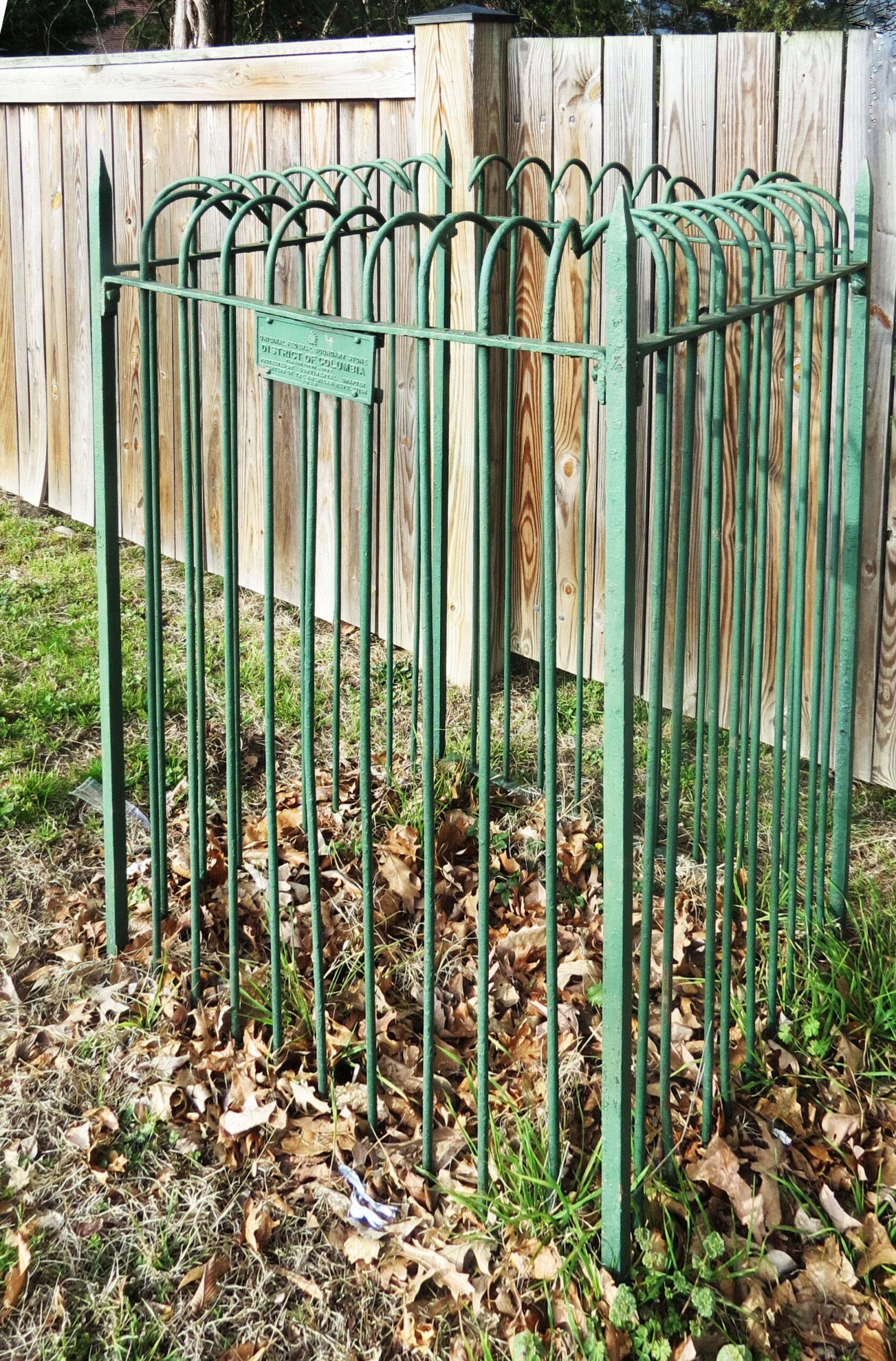
For additional information, read the Nomination Form PDF
VLR Listing Date 08/21/1990
NRHP Listing Date 02/01/1991
NRHP Reference Number 91000009
Southwest No. 4 Boundary Marker of the Original District of Columbia is located on King Street just north of Wakefield Street in the city of Alexandria adjacent to the Fairlington Village Condominiums. Only a small portion of the original Aquia sandstone survives, having been struck numerous times by plows in the 19th century. The SW No. 4 Boundary Mile marker was moved due to construction on King Street (Route 7), and it was replaced close to its original location. The marker was in the immediate vicinity of three federal forts marking the line of the defenses of the District of Columbia in the Civil War. The Southwest No. 4 Boundary Marker was listed under the Multiple Property Document (MPD) form for the Boundary Markers of the Original District of Columbia.
Many properties listed in the registers are private dwellings and are not open to the public, however many are visible from the public right-of-way. Please be respectful of owner privacy.
Abbreviations:
VLR: Virginia Landmarks Register
NPS: National Park Service
NRHP: National Register of Historic Places
NHL: National Historic Landmark
Updated: April 3, 2023


