 Virginia Department of Historic Resources Virginia Department of Historic Resources
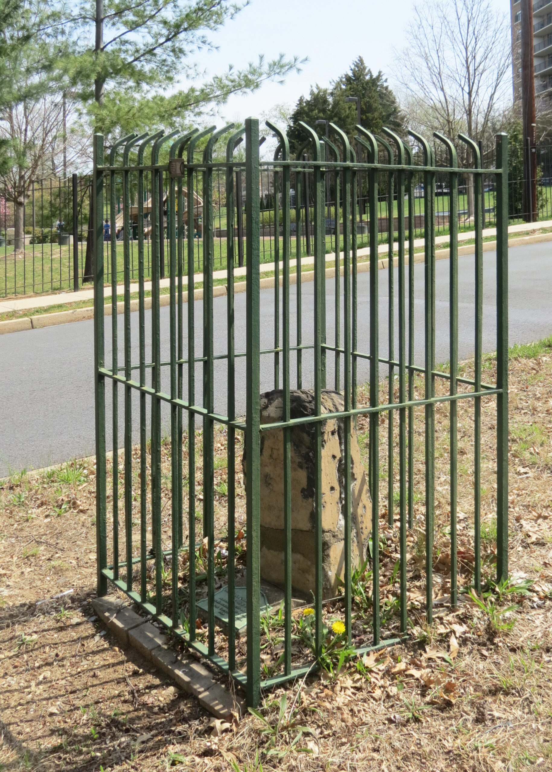
For additional information, read the Nomination Form PDF
VLR Listing Date 08/21/1990
NRHP Listing Date 02/01/1991
NRHP Reference Number 91000011
The Southwest No. 6 Boundary Marker of the Original District of Columbia is located in the median strip of South Jefferson Street between Columbia Pike and Leesburg Pike in Arlington County. The No. 6 mile marker was the second Virginia stone that was set at an uneven distance because the end of that mile of the boundary line was in a stream. Its original wrought iron protective fence was placed in 1916; by 1949 the fence was gone and the stone sat on the edge of a large gravel pit. Threatened by construction of roads and apartments, the Southwest No. 6 Boundary stone was removed and stored by Arlington County for three years. It was then placed in the middle of the median strip on South Jefferson Street, this being the closest public land next to its original site. It was given a new iron fence and rededicated in its new location in June 1965. The Southwest No. 6 Boundary Marker was listed under the Multiple Property Document (MPD) form for the Boundary Markers of the Original District of Columbia.
Many properties listed in the registers are private dwellings and are not open to the public, however many are visible from the public right-of-way. Please be respectful of owner privacy.
Abbreviations:
VLR: Virginia Landmarks Register
NPS: National Park Service
NRHP: National Register of Historic Places
NHL: National Historic Landmark
Updated: April 23, 2023


