 Virginia Department of Historic Resources Virginia Department of Historic Resources
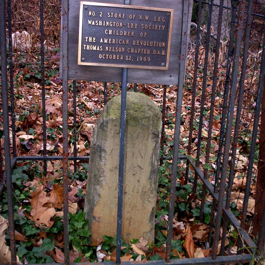
For additional information, read the Nomination Form PDF
VLR Listing Date 08/21/1990
NRHP Listing Date 02/01/1991
NRHP Reference Number 91000004
The District of Columbia boundary stones in Virginia are sandstone markers erected in 1791, when the site of the City of Washington was first determined. The original area of the District was ten miles square and 20 stones were placed at one mile intervals along the boundary line in Virginia. The stones were about one foot square with beveled tops, and protruding from two to three feet above the ground. In 1915, the Daughters of the American Revolution began the recovery of the stones, many of which were by then lost or buried in debris. The Northwest No. 2 Boundary Marker of the Original District of Columbia is located in the backyard of a private property on North 38th Street on the boundary of Arlington and Fairfax counties. The Northwest No. 2 Boundary Marker was listed under the Multiple Property Document (MPD) form for the Boundary Markers of the Original District of Columbia.
Many properties listed in the registers are private dwellings and are not open to the public, however many are visible from the public right-of-way. Please be respectful of owner privacy.
Abbreviations:
VLR: Virginia Landmarks Register
NPS: National Park Service
NRHP: National Register of Historic Places
NHL: National Historic Landmark
Updated: May 1, 2023


