 Virginia Department of Historic Resources Virginia Department of Historic Resources
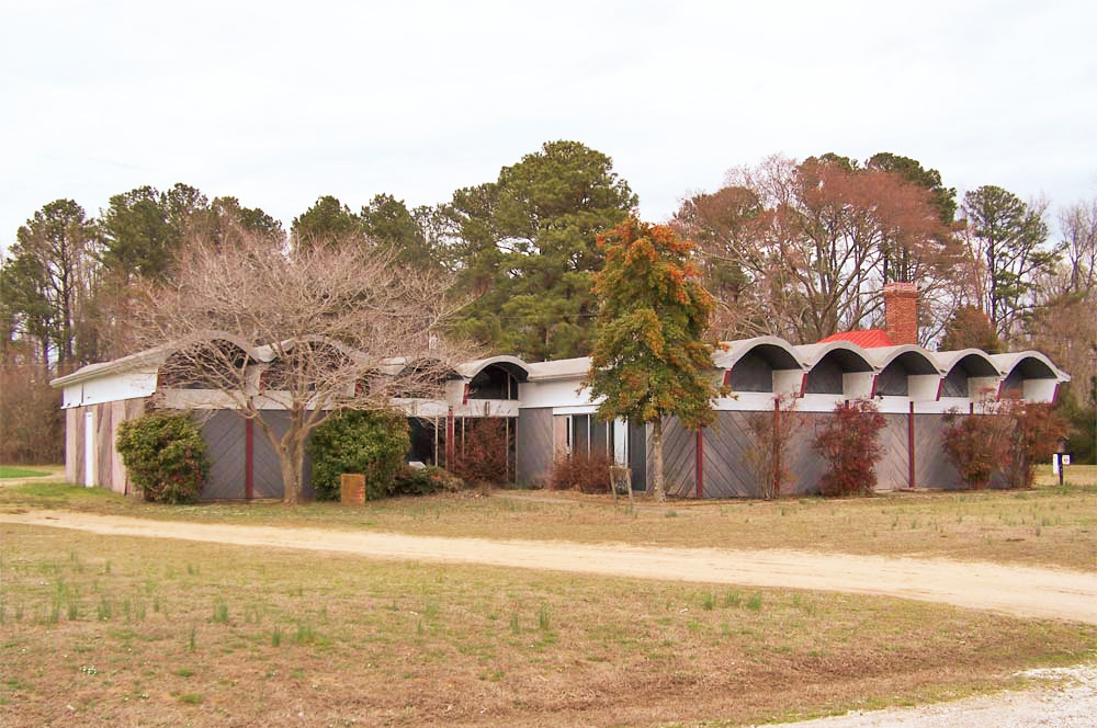
For additional information, read the Nomination Form PDF
VLR Listing Date 10/21/1980
NRHP Listing Date 09/16/1982
NRHP Reference Number 82004567
Over 7,000 years of Native American occupation of the Pamunkey Indian Reservation Archaeological District, on a 1,700-acre, marsh-rimmed, Pamunkey River peninsula in King William County, give this tract unique archaeological interest. A survey undertaken in 1979 by archaeologists of the Virginia Department of Historic Resources and Virginia Commonwealth University identified fifteen sites ranging from the Middle Archaic period (5000-3000 B.C.) to the post-settlement era. The Pamunkey tribe was first identified by Europeans when Capt. John Smith explored the upper reaches of the York River in 1607. By the end of the 20th century, the Pamunkey Indian Reservation sustained about seventy inhabitants, representing a continuity of many centuries. Further archaeological research could trace the cultural evolution and adaptation of the Pamunkey tribe from the time of contact with European civilization through subsequent phases of Virginia history. The Tribal Cultural Center (shown), its design inspired by the round-roofed Indian houses shown in early engravings, displays Pamunkey artifacts and crafts.
Many properties listed in the registers are private dwellings and are not open to the public, however many are visible from the public right-of-way. Please be respectful of owner privacy.
Abbreviations:
VLR: Virginia Landmarks Register
NPS: National Park Service
NRHP: National Register of Historic Places
NHL: National Historic Landmark
Updated: November 23, 2022


