 Virginia Department of Historic Resources Virginia Department of Historic Resources
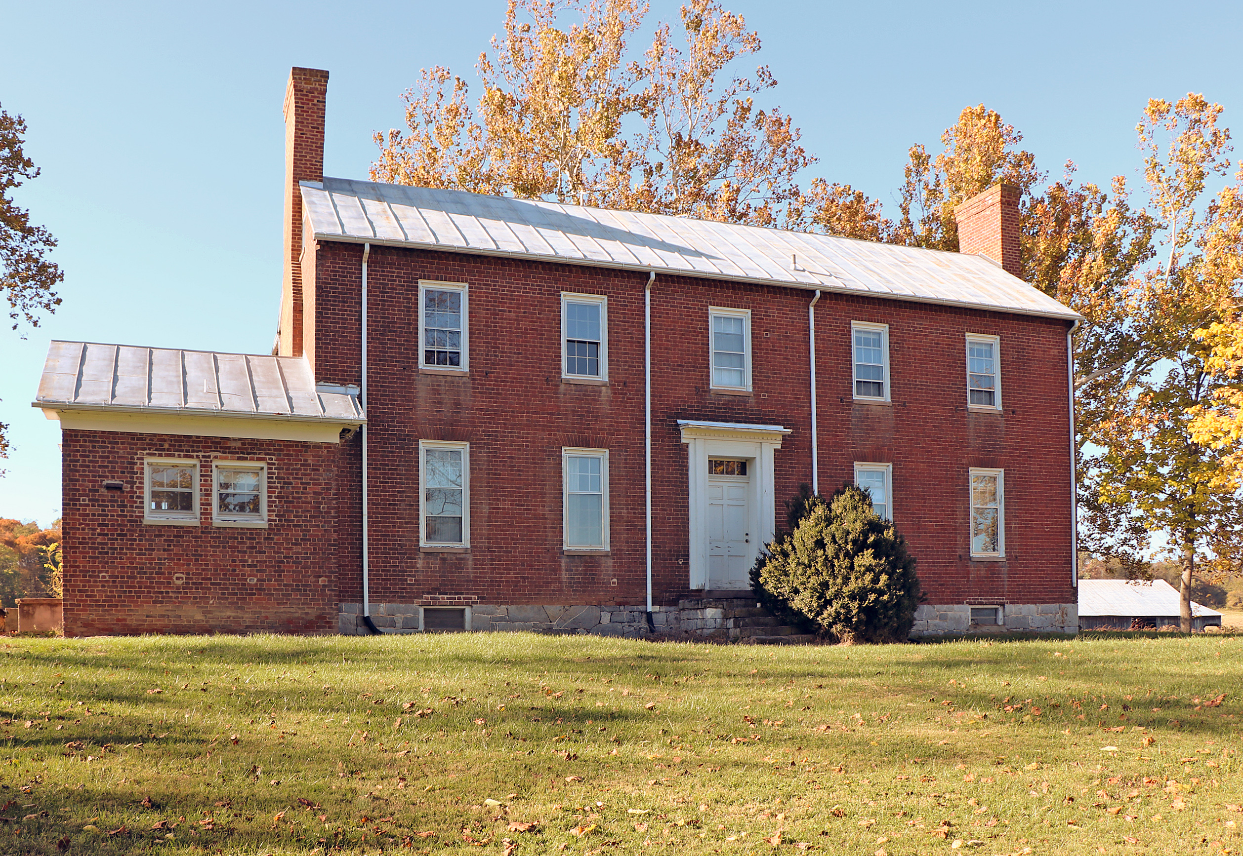
For additional information, read the Nomination Form PDF
See link(s) below to view additional documentation.
VLR Listing Date 04/17/1991
NRHP Listing Date 07/03/1991
NRHP Reference Number 91000833, 06000801
James Randal Kent (1792-1867) assembled the Kentland plantation in the early 19th century, and by 1860 had holdings of 6,000 acres worked by 123 enslaved individuals. Kent completed his immense plantation house in 1835. One of Montgomery County’s most ambitious early dwellings, the brick mansion has sophisticated Federal detailing including important carved mantels. The prehistoric archaeological resources of Kentland include the sites of a Late Woodland period village and camp sites. The Kentland Farm Historic and Archaeological District also incorporates Buchanans Bottom, one of the earliest patented tracts on the New River drainage (1750), as well as a portion of Adam Harmon’s Ford, the southern terminus of the mid-18th-century Shenandoah Valley Indian Road. Also in the district are several late-19th- and early-20th-century farm buildings and the 19th-century Kent Cowan Mill. The property is now owned and managed by Virginia Tech.
The Kentland Farm Historic and Archaeological District was listed in the registers under the Prehistoric and Historic Resources of Montgomery County MPD.
In 2006, DHR amended the original register listing for the Kentland Farm Historic and Archaeological District to add a newly identified and previously unrecorded slave cemetery, and to include additional documentation on the Kentland domestic complex, the Kentland slave quarters, and the Orchard Drive Slave Cemetery. These new additions, the result of ongoing archaeological research conducted through a partnership between DHR and Virginia Tech, contribute significantly to our understanding of plantation life in Southwest Virginia. The domestic site reveals the existence of a 19th-century kitchen, as well as the 19th-century remains of planter James R. Kent’s office, and a building that housed enslaved individuals and subsequent tenant workers at the farm. Members of the nearby Wake Forest community, many descendants of persons enslaved at Kentland, recalled oral histories recounted to them by their grandparents who had been enslaved at Kentland that indicated the existence of the previously undocumented African American cemetery. Archaeological investigation with the Kentland Farm Historic and Archaeological District confirmed the cemetery, recording evidence for 23 human graves.
[VLR Listed: 6/8/2006; NRHP Listed: 9/6/2006]
2006 Amendment and Boundary Adjustment Nomination
Many properties listed in the registers are private dwellings and are not open to the public, however many are visible from the public right-of-way. Please be respectful of owner privacy.
Abbreviations:
VLR: Virginia Landmarks Register
NPS: National Park Service
NRHP: National Register of Historic Places
NHL: National Historic Landmark
Updated: October 26, 2022


