 Virginia Department of Historic Resources Virginia Department of Historic Resources
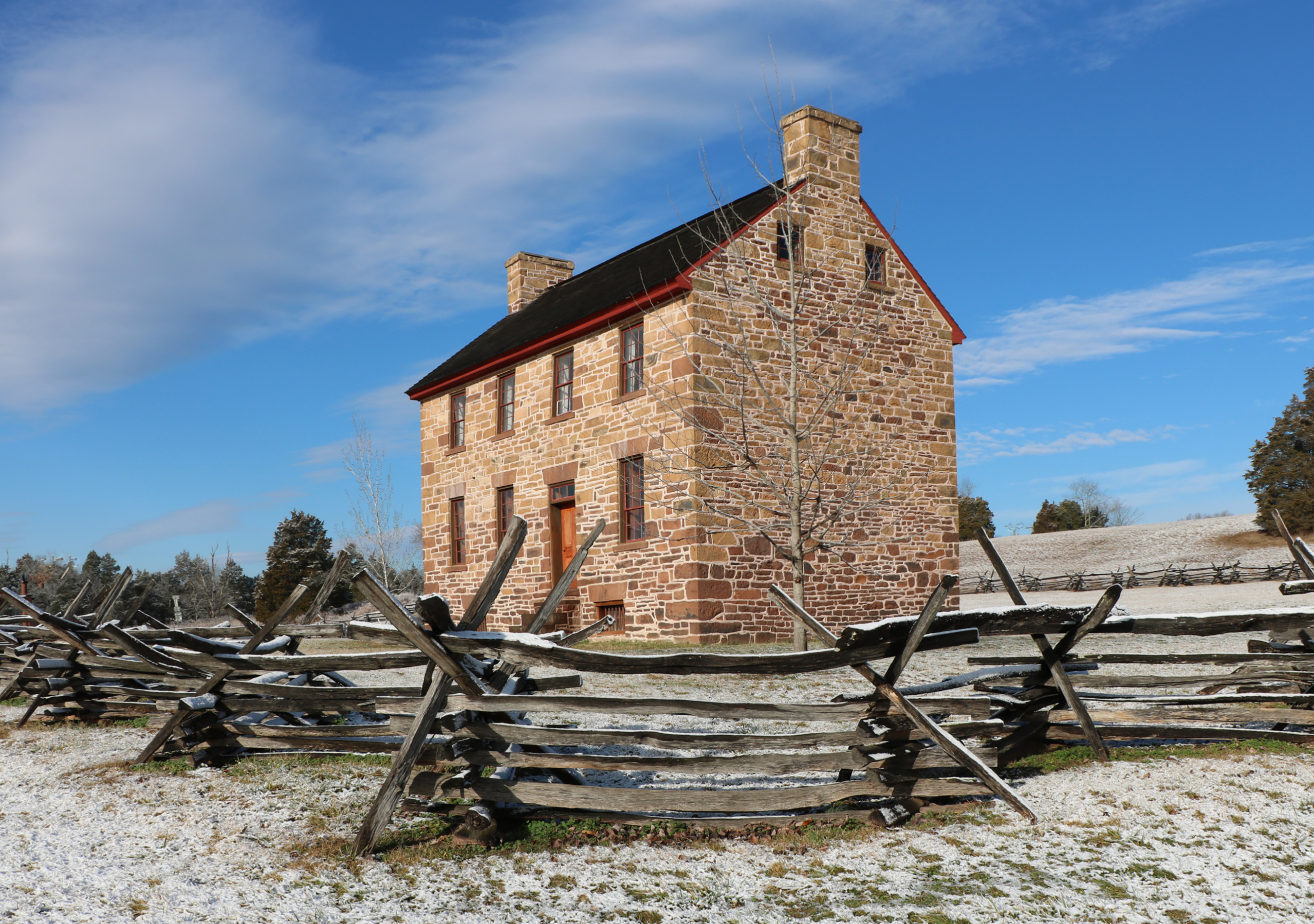
For additional information, read the Nomination Form PDF
See link(s) below to view additional documentation.
VLR Listing Date 01/16/1973
NRHP Listing Date 10/15/1966
NRHP Reference Number 66000039; 05001546
The 300-acre Manassas National Battlefield Park tract, bordered by Bull Run, was the scene of two Confederate victories during the Civil War. The first battle of Manassas, fought on July 21, 1861, was the opening engagement of the Civil War and pitted Union Brig. Gen. Irvin McDowell’s unseasoned troops against ill-trained but spirited Confederates under Brig. Gen. P. G. T. Beauregard. The Union attack was repulsed by Confederates inspired by Gen. Thomas J. “Stonewall” Jackson and his Virginians, who stood against the enemy like a “stone wall,” earning Jackson his famous epithet. Second Manassas, fought on August 28-30, 1862, cleared the way for Gen. Robert E. Lee’s first invasion of the North. Surviving landmarks include the Dogan House, a Union snipers’ nest in 1862; the Stone House (pictured above), a Union field hospital during both battles; and the Stone Bridge, blown up in 1861 but reconstructed in the 1880s. The battlefield is a property of the National Park Service.
The expanded Manassas Battlefield Historic District contains approximately 6,469.54 acres of Virginia landscape historically significant for its association with the First Battle of Manassas on July 21, 1861 and the Second Battle of Manassas on August 28-30, 1862. Preservation and commemoration of this hallowed ground led to the creation of Manassas National Battlefield Park in 1940. Today, the battleground is sufficiently intact to allow vistas not unlike those observed by the commanding generals and the thousands of soldiers who fought there. At the time of the listing of this updated nomination approximately 5,073.10 acres of the battlefield site were located within the authorized boundaries maintained by the National Park Service as Manassas National Battlefield Park.
[VLR Listed: 10/6/2004; NRHP Listed: 1/18/2006]
2004 Amended Nomination and Boundary Increase
Many properties listed in the registers are private dwellings and are not open to the public, however many are visible from the public right-of-way. Please be respectful of owner privacy.
Abbreviations:
VLR: Virginia Landmarks Register
NPS: National Park Service
NRHP: National Register of Historic Places
NHL: National Historic Landmark
Updated: February 13, 2023


