 Virginia Department of Historic Resources Virginia Department of Historic Resources
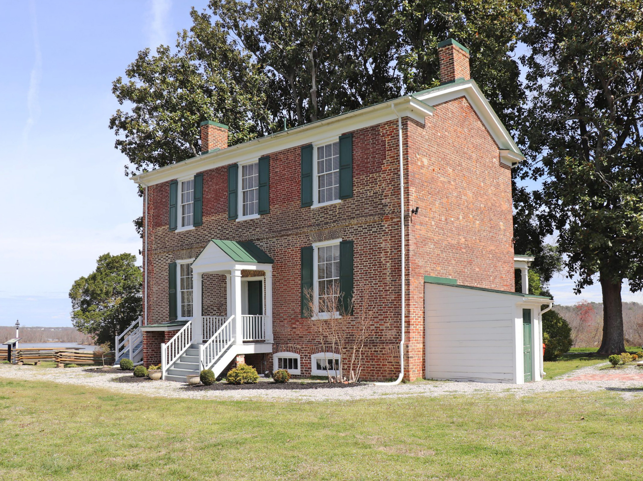
For additional information, read the Nomination Form PDF
VLR Listing Date 06/18/2003
NRHP Listing Date 10/23/2003
DHR's Virginia Board of Historic Resources easement
NRHP Reference Number 03001090
Conjurer’s Field (Conjurer’s Neck Archaeological District) is situated on a peninsula where Swift Creek meets the Appomattox River in the City of Colonial Heights. It contains a prehistoric village site already listed in the state and national registers, as well as a portion of a major 18th-century plantation house built by the Kennon family. The site was named by early English explorers who allegedly encountered a Virginia Indian religious leader there. Richard Kennon settled on the land in the 1680s. One of his descendants constructed the Flemish-bond manor house between 1725 and 1750. It burned in 1879, and about half of the standing walls were used to create the present three-bay, two-story dwelling. Originally it was a five-bay house, similar to the Ludwell-Paradise House in Williamsburg. Archaeological investigation in Conjurer’s Neck Archaeological District has provided information on the in-filled cellar remains of the house and remains of associated outbuildings. A prehistoric component at the site consists of an accumulation of Middle and Late Woodland lithics and ceramics likely related to the previously identified Conjurer’s Field prehistoric site.
Many properties listed in the registers are private dwellings and are not open to the public, however many are visible from the public right-of-way. Please be respectful of owner privacy.
Abbreviations:
VLR: Virginia Landmarks Register
NPS: National Park Service
NRHP: National Register of Historic Places
NHL: National Historic Landmark
Updated: November 7, 2022


