 Virginia Department of Historic Resources Virginia Department of Historic Resources
Below are links to maps for select cities and counties that show the boundaries of historic districts listed in the Virginia Landmarks Register (VLR) and the National Register of Historic Places (NRHP) within each jurisdiction. For information on historic districts in other localities, please contact the Archives of the Department of Historic Resources.
The historic district boundaries depicted in the maps may not correspond with the boundaries of local historic districts. DHR’s maps focus only on VLR and NRHP districts, and do not indicate districts authorized solely by localities. (Designation of a property to the state and national registers is honorary; it places no restrictions on what a property owner may do with his or her property.)
Note: In order to read and print the maps below Adobe Acrobat Reader must be installed on your computer (free software). Download Acrobat Reader now.
Alexandria VLR / NR Historic District Map
Arlington County VLR / NR Historic District Maps
Bristol VLR / NR Historic District Map
Charlottesville VLR / NR Historic District Map
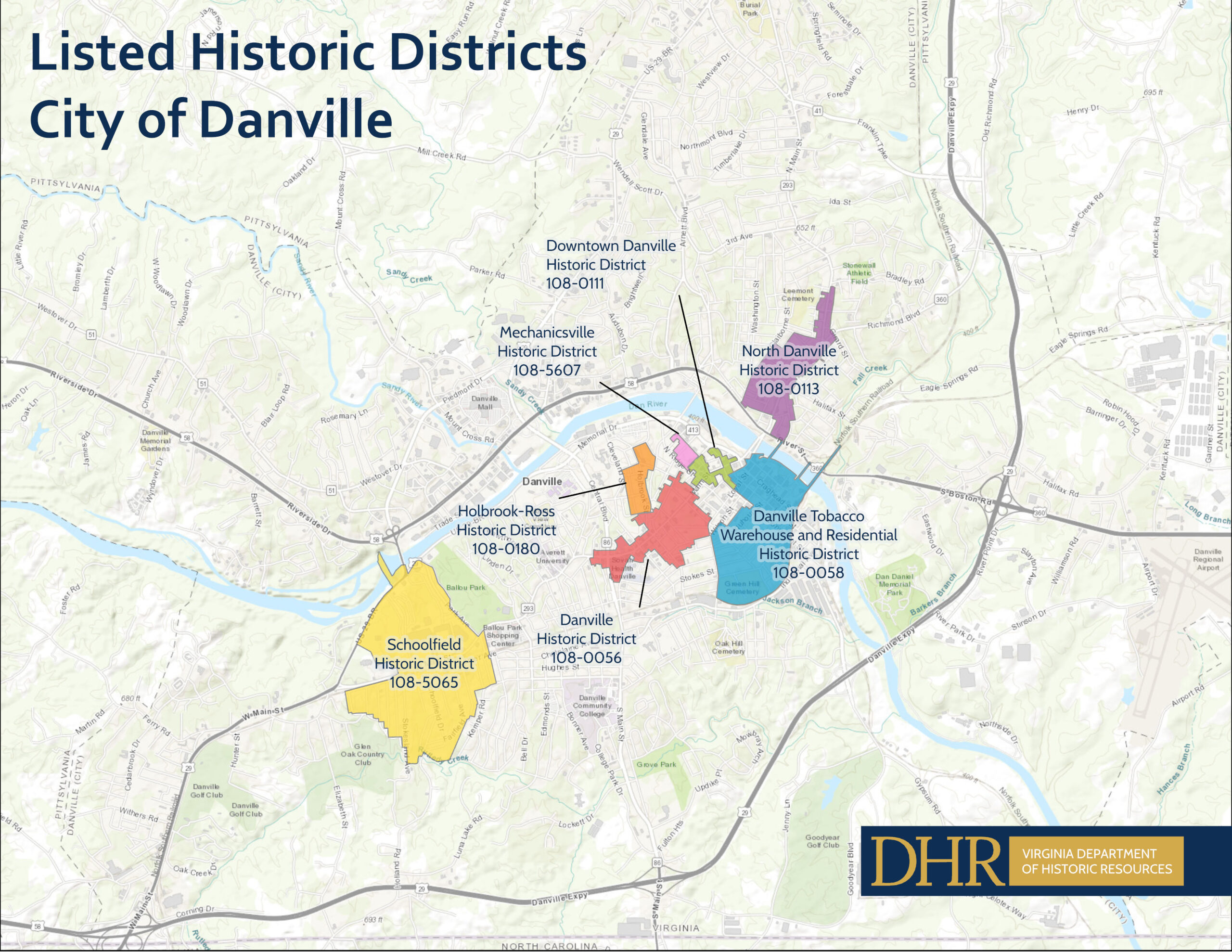
Danville VLR / NR Historic District Map
Fredericksburg VLR / NR Historic District Map
Lynchburg VLR /NR Historic District Map
Martinsville VLR / NR Historic District Map
Norfolk VLR / NR Historic District Map
Petersburg VLR / NR Historic District Map
Portsmouth VLR / NR Historic District Map
Richmond City VLR / NR Historic District Map
Roanoke City VLR / NR Historic District Map
Staunton VLR / NR Historic District Map
Suffolk VLR / NR Historic District Map
Williamsburg VLR / NR Historic District Map
Updated March 14, 2023


